|
| |
| Southern Ocean Antarctic toothfish fishery - Southeast Atlantic (Subarea 48.6) |
 | Exploratory fishery for Dissostichus mawsoni in Subarea 48.6 |
| | Data Ownership | | This document provided, maintained and owned by Commission for the Conservation of Antarctic Marine Living Resources (CCAMLR) , is part of CCAMLR Fisheries Reports data collection. |
|
Fishery life cycleThis fishery started in 1997.
more>> <<less Overview: This fishery began as a new fishery in 1997 (Conservation Measure 114/XV). Following the Commission’s decision that high levels of illegal, unreported and unregulated (IUU) fishing for Dissostichus spp. in the Convention Area had rendered it unrealistic to consider this fishery as ‘new’ (CCAMLR-XVIII, paragraph 10.14), the fishery was reclassified as exploratory in 2000. Prior to 2017, this fishery was an exploratory fishery for Dissostichus spp., however, in order to better align the target species with the predominant species in this subarea the target species was specified as D. mawsoni, with any Patagonian toothfish (D. eleginoides) caught counting towards the catch limit for D. mawsoni.
|
|
Harvested Resource Type of production system: Exploratory fishery Fishery Area Climatic zone: Polar. Depth zone: Abyssal ( >1000m). Horizontal distribution: Oceanic. Vertical distribution: Demersal. Geo References for: Subarea 48.6 
Subarea 48.6
| FAO Fishing Statistical Sub Areas | 48.6 - Atlantic Antarctic / 48.6 | | RFB competence | CCAMLR - CCAMLR area of competence |
More Geo References The following area codes have been found as intersecting the location of Southern Ocean Antarctic toothfish fishery - Southeast Atlantic (Subarea 48.6)Associated Species (Bycatch) Vessel Type Bottom longliners Catch Handling and Processing Equipment Factory Flag State  Spain  Japan  South Africa Seasonality All year (CCAMLR season is from 1st of December to 30th of November). Environmental limitationsRefer to CCAMLR Conservation Measures List of fishery Indicators Fishery Indicators | Type | Measure | Value | Unit | Time period |
|---|
| Nominal Effort | Number of vessels | 3 | vessels | 2020 | | Number of vessels | 2 | vessels | 2019 | | Number of vessels | 2 | vessels | 2018 | | Number of vessels | 2 | vessels | 2017 | | Number of vessels | 2 | vessels | 2016 | | Number of vessels | 2 | vessels | 2015 | | Number of vessels | 2 | vessels | 2014 | | Number of vessels | 2 | vessels | 2013 | | Number of vessels | 2 | vessels | 2012 | | Number of vessels | 4 | vessels | 2011 | | Number of vessels | 3 | vessels | 2010 | | Number of vessels | 2 | vessels | 2009 | | Number of vessels | 1 | vessels | 2008 | | Number of vessels | 3 | vessels | 2007 | | Number of vessels | 1 | vessels | 2006 | | Number of vessels | 2 | vessels | 2005 | | Number of vessels | 1 | vessels | 2004 | | Production | Catch | 333 | tonnes | 2020 | | Catch | 376 | tonnes | 2019 | | Catch | 517 | tonnes | 2018 | | Catch | 435 | tonnes | 2017 | | Catch | 232 | tonnes | 2016 | | Catch | 188 | tonnes | 2015 | | Catch | 145 | tonnes | 2014 | | Catch | 275 | tonnes | 2013 | | Catch | 375 | tonnes | 2012 | | Catch | 317 (quarantined data:42) | tonnes | 2011 | | Catch | 243 (quarantined data:100) | tonnes | 2010 | | Catch | 93 (quarantined data:173) | tonnes | 2009 | | Catch | 11 | tonnes | 2008 | | Catch | 34 | tonnes | 2007 | | Catch | 63 | tonnes | 2006 | | Catch | 2 | tonnes | 2005 |
Post Harvest Fish Utilisation Frozen, meal Management Management unit: Yes Legal definition Conservation Measure 41-04 and related measures Jurisdictional framework Mandate: Scientific Advice; Management; Monitoring; Control and surveillance. Area of Competence: CCAMLR area of competence Maritime Area: High seas. Management Regime Ecosystem-based, precautionary approach Management Methods Ecosystem-Based Fisheries Management (EBFM) with focus on Conservation of living marine resources - Binding Development of integrated assessment, precautionary approach. Refer to CCAMLR Conservation Measures (see Source of Information). Status and Trends Type of Fishery: Exploratory. In this fishery, the catch of D. mawsoni reached a maximum of 517 tonnes in 2018. In 2020, 4 tonnes of D. eleginoides and 333 tonnes of D. mawsoni were caught. Source of Information CCAMLR. 2021. Fishery Report 2020: Dissostichus mawsoni in Subarea 48.6.  https://fishdocs.ccamlr.org/FishRep_486_TOA_2020.pdf https://fishdocs.ccamlr.org/FishRep_486_TOA_2020.pdfCCAMLR. 2020. Conservation Measure 41-04 (2020). Limits on the exploratory fishery for Dissostichus mawsoni in Statistical Subarea 48.6 in the 2020/21 season.  https://www.ccamlr.org/en/measure-41-04-2020 https://www.ccamlr.org/en/measure-41-04-2020CCAMLR. Conservation Measure 114/XV (1996). New Fishery for Dissostichus eleginoides and D. mawsoni in Statistical Subarea 48.6 in the 1996/97 Season. https://www.ccamlr.org/en/measure-114/xv-1996 |
|


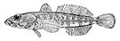 Dissostichus eleginoides